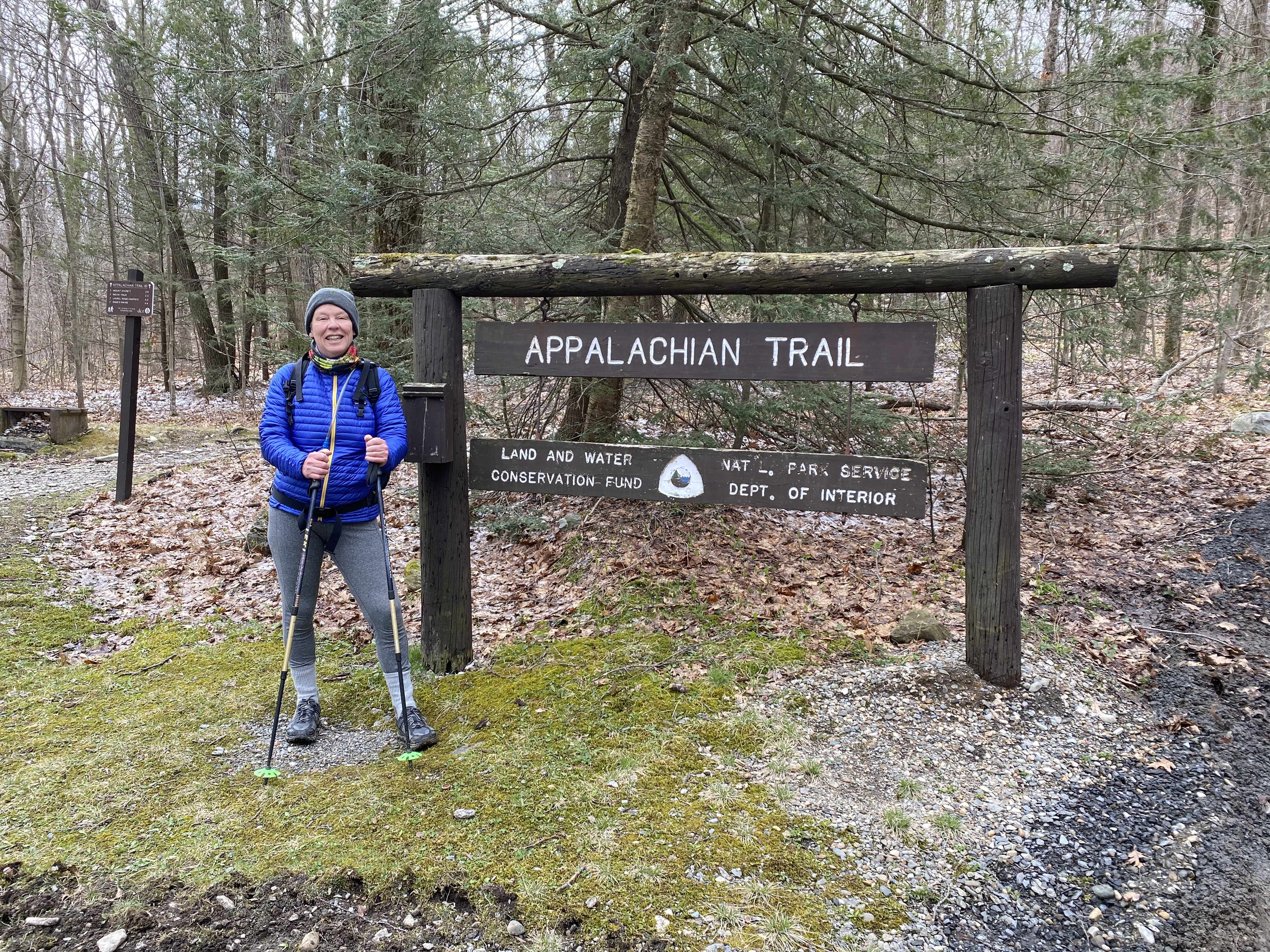
About our Project — and an Introduction to Hiking the AT in Massachusetts.
It was 37 degrees on the early May morning D. and I left for our planned 6.6 mile dayhike on the Appalachian Trail. Before we even took our first step, 6.6 miles turned into to 8-ish miles. Thanks to Covid, the gate to the road to the trailhead at Guilder Pond was closed. Rather than drive to the trailhead, we’d have to walk.
The closure was due to overcrowding: the year of Covid was the year people rediscovered the great — and safe — outdoors. Berkshire County had a bull’s eye on it. We’re a bucolic weekend getaway a mere two hours from New York City, and so many visitors came to our local beauty spots that parking areas were closed to prevent overcrowding. Of course, that just meant that people moved on to other beauty spots, which in turn also became overcrowded. And so on. In early May, 2021, Covid restrictions remained in effect, and the gate at the Mt. Everett Reservation was firmly locked. It’s a sad comment that all the managers had to do to reduce crowding at the pond was make people walk a mile to get there.
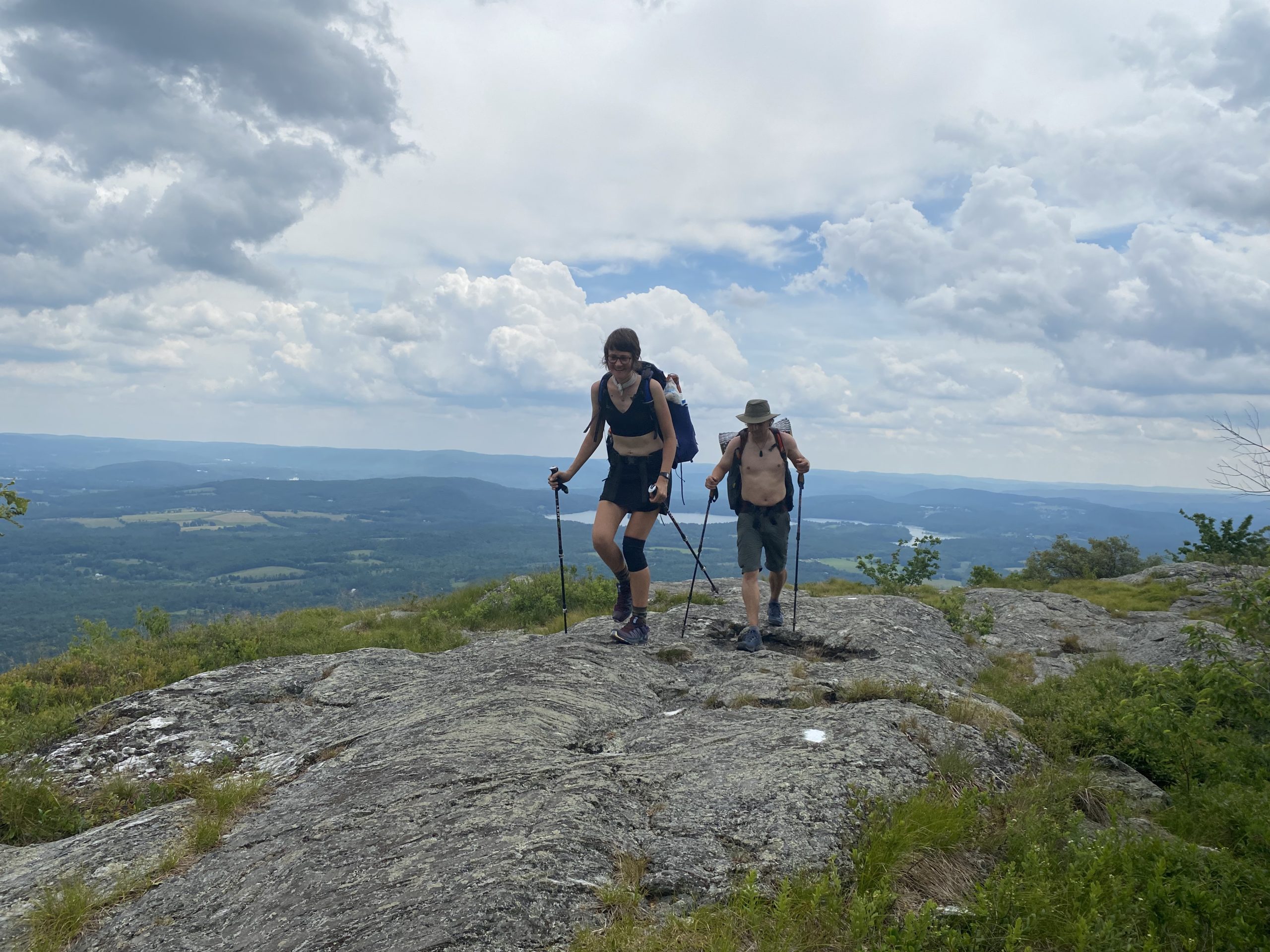
This stretch of trail is my home territory, only three miles from my house. I don’t even know how many times I’ve hiked this bit. If I park at Jug End Road and head south, the AT offers a stiff climb that serves as my training ground for when I am getting ready to hike in steep and high places. What was special about this particular hike was that it was D.’s first stretch of her intended section hike of the entire 2200 mile Appalachian Trail.
A Lesson About Expectations and Realities
For D. and me, there seemed to be a message in that locked gate and the extra hiking to reach the trailhead: a valuable reminder about the nature of backpacking. No matter how much planning you do, something unexpected can always happen. It might involve extra miles, a surprise climb, a trail closure or relocation, or rain that wasn’t in the forecast.
I think for long-distance hikers, there is always some tug-of-war between enjoying where you are and moving on to the next place. A thru-hike has a goal — getting to the other end, and anything that gets in the way of that goal can be seen as an obstacle. We humans are not inclined to celebrate obstacles; instead, we try to overcome them. Section hikers , on the other hand, are less goal oriented. As a section hiker, I can can opt out of a planned hike if it’s raining. If I skip a section, I can make up the missed mileage on a future hike. Or I can shrug and just do a couple more miles, figuring that there is a good meal and a soft bed waiting for me at the end of the day. D. and I were both delighted to be outside: an extra mile meant an extra half hour in a place we wanted to be. We had plenty of time, plenty of daylight, and plenty of food. The weather was good, and we were pretty sure we had plenty of energy. Our planned mileage was low enough — even for a first day of hiking — that the extra smidge didn’t matter.
D. and Me: Hiking Partners
Some background, in case you missed my previous post: My friend D. is doing the AT as a 60th birthday project, over the next few years. But no offense: she wants nothing to do with you. Actually, she wants nothing to do with FB and Instagram and this, or any other, blog: D. is a social media refugee who values anonymity. I, on the other hand, have been writing books, articles, and blogs about hiking and backpacking for decades and have been interviewed on the subject by everyone from the New York Times to Martha Stewart radio. My superpower is learning new stuff and sharing it with others. So I will be writing and photographing D. will be hiding from the camera. And we will both be walking and talking.
Other than the whole social media thing, D. and I seem hiking- compatible — we’re good regarding sharing food, we hike at about the same pace, we are flexible, we seem copacetic when dealing with the unexpected, and we laugh about our mistakes. And we’ve made plenty of them. So far, those mistakes have included parking at the wrong trailhead (which led to an extra 2.5 miles of hiking), misplacing the keys for one of the shuttle cars (a family member needed to come to the rescue), leaving food behind (that was me: I now remind myself to bring my lunch by leaving a piece of paper with the word “food” on it sitting by the door), and forgetting our trekking poles (both of us, on the same day).
That first hike was about 6 weeks ago, and we’ve been going out once or twice a week since then.
Massachusetts AT Mileage and Miles per Hour
The AT runs about 90 miles in Massachusetts. So far, we’ve hiked Massachusetts from Guilder Pond (in the southern section of the state, near Mt. Everett) to Dalton (in the north). Our longest day so far has been about 12.5. We seem to be averaging about 2 mph. I’m offering that information just to give you a reference point: if you are starting an AT hike, you want to start with manageable mileage that makes you feel good. D. and I aren’t young, but both of us are fit and we’re active year round, with athletic backgrounds that mean our bodies adjust well when they are asked to do some hard work. The mileage we have been doing has felt invigorating but easy. With a pack, it’ll be more work, of course.
All that’s left in our home state is a dayhike near Dalton, an overnight over Mt. Greylock, and an overnight from Guilder Pond to the first road crossing in Connecticut in the south. We might finish the state by next weekend!
An Overview of The AT in Massachusetts
I think Massachusetts has some of the AT’s easier sections. I remember from my thru-hiker days and from other treks in Massachusetts, that the hardest miles and biggest climbs are at either end. On the southern end, a rocky ridge slows progress WAY down, and in the north, Mt. Greylock, the state high point, is a 2500-foot climb, which is more than anything northbound thru-hikers have seen since Virginia. It’s sort of a welcome map to the real New England.
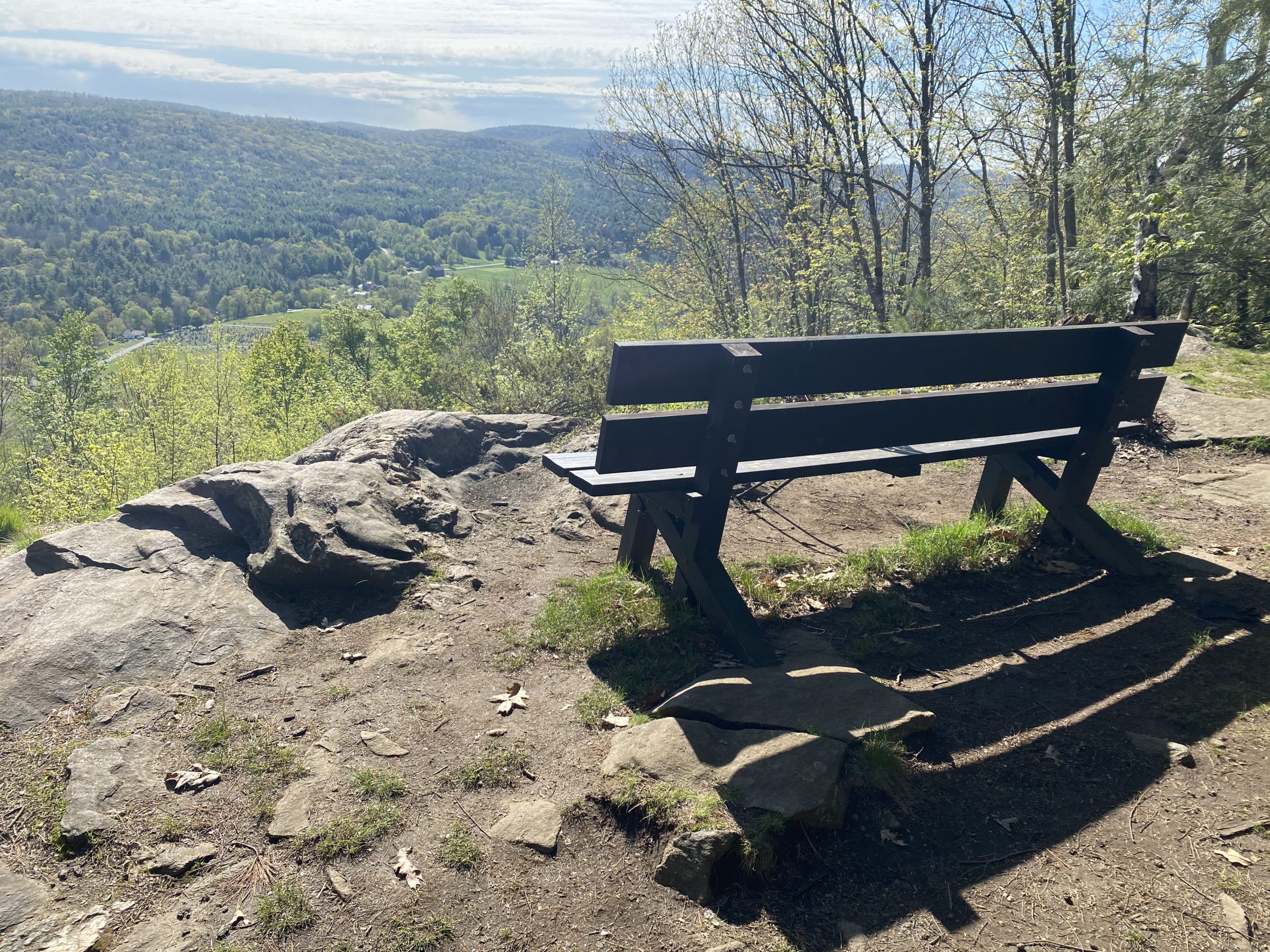
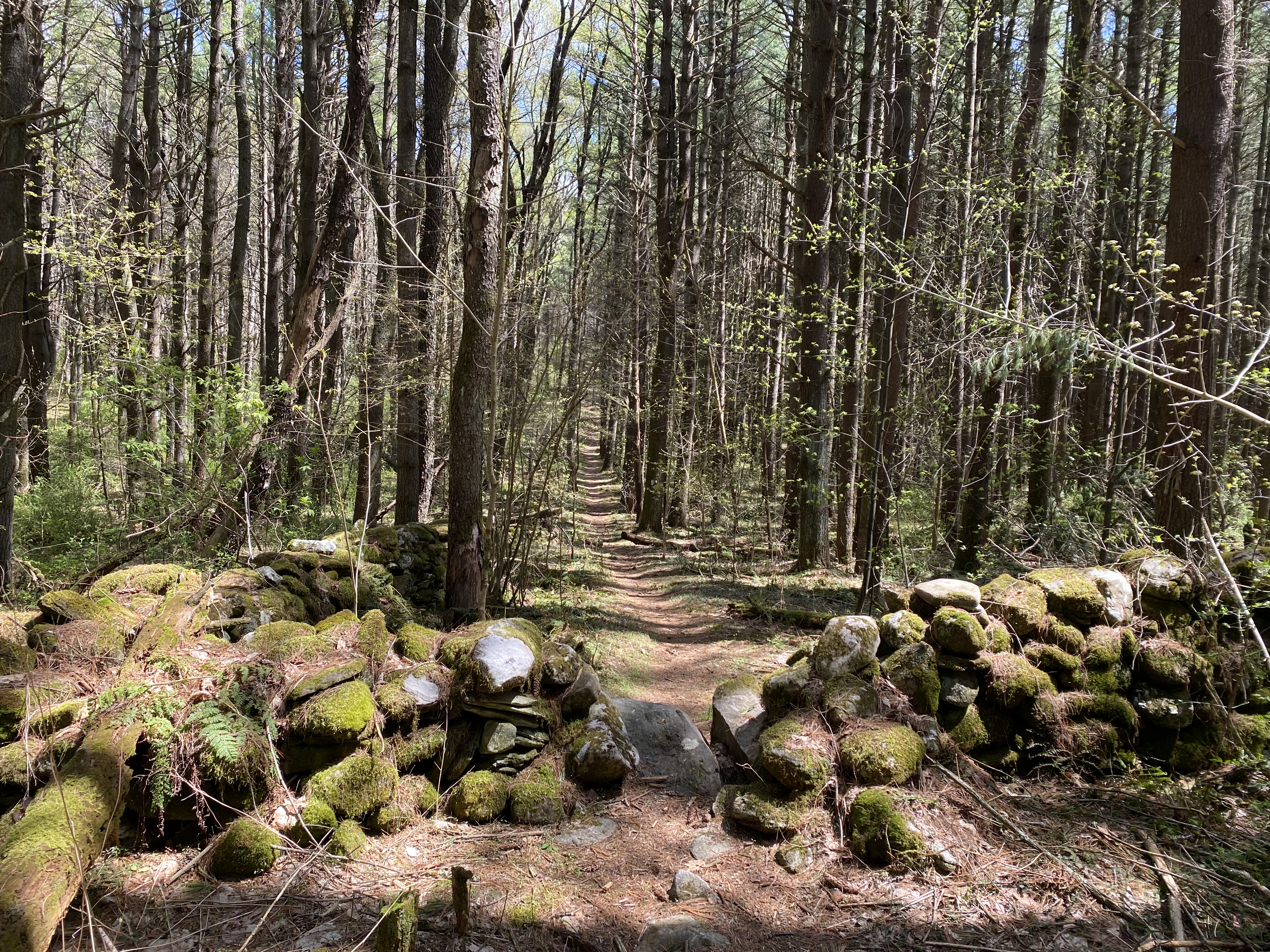
In between, the going is relatively easy, with occasional gnarly sections of ankle-twisting boulder chutes, a couple of steep grades, and a bit of rock-and-puncheon hopping to get through boggy spots. But for the most part, the moniker “long green tunnel” applies. What you’ll see are a dozen different forest ecosystems — ferns, pines, hardwoods, ridgeline scrub — along with river basin floodplains, farmlands and fields, traditional stone walls, and the occasional view from a high point. May and June are perfect, though as the weather warms up and the bugs come out, you’ll want some bug dope on hand. Also note that this region has a massive tick problem: pemetherin-treated clothing, DEET, and daily skin checks are all advisable, because this is Lyme disease central.
Other notes: So far water hasn’t been an issue. Spring rains have been heavy this year, and all seasonal streams have been full, as they tend to be this time of year. That will change by late summer, so consider season when you plan for water. As far as trail conditions go, maintainers have done an excellent job. Most boggy areas have puncheons, and though I’ve been wearing trekking shoes rather than boots, I’ve never (yet) sunk into mud that got inside my footwear. Many shelters have bear boxes. Use them, because as a local I can say for certain that there are lots of bears around (I’ve got pictures of their footprints in my driveway, and I live only three miles from the AT). Road crossings are frequent — every few miles — and it is possible to park at most (but not all) of them: the ALDHA thru-hikers guide and the online AT interactive map are the best sources for this info. Note that cell phone service is not available on many of the back dirt roads or in the forests, but it is often available once you reach a summit or a ridgeline. Finally, watch for poison ivy at the lower elevations starting in late May.