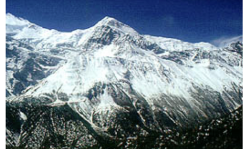
If you want to see a sea of mountains for as far as the horizon goes, there’s no better place than Colorado’s Continental Divide National Scenic Trail — all 800 miles of it, which run approximately 800 miles from the New Mexico border to the Wyoming border. It’s part of the Continental Divide National Scenic Trail, but as a summer-long hike, it stands alone. At an average elevation of more than 11,000 feet, it also rises far above the rest of the C.D.T.

The C.D.T. is one of 11 long-distance trails in America’s National Scenic Trails System, and one of the three so-called “Triple Crown Trails” (The other two are the Appalachian Trail and the Pacific Crest Trail Continental Divide). The Colorado C.D.T. contains the Continental Divide’s highest peaks, along with some of its most remote wildernesses and most spectacular mountain scenery.
Primarily a hiking and horseback riding trail, the Colorado C.D.T. also offers recreational opportunities to llama trekkers, cross country skiers and snow-shoers (in winter, of course), dayhikers, and campers. In some multiple use areas, hikers also share the trail (or dirt roads the trail occasionally follows) with mountain bikes, and, less often, with ATVs and four-wheel-drive vehicles.
Regardless of the type of recreation, the Colorado Continental Divide poses challenges. Its elevations occasionally soar above 13,000 feet, and the entire trail averages more than 11,000 feet in elevation, making it the longest high trail in the United States. It is also remote: In some wilderness areas, such as the Weminuche in the San Juan Mountains, or the Mt. Zirkel Wilderness in northern Colorado, the trail doesn’t even cross a road for days at a time. Hikers, riders, and other users must therefore be competent outdoorspeople, with the judgment and experience to deal with high country obstacles such as ice and snow (even in summer), bad weather, and route-finding difficulties.
Routefinding Tips for the Colorado Continental Divide
Bring a guidebook. Two are available. Colorado’s s Continental Divide Trail: The Official Guide by Tom Lorang Jones (Westcliffe Publishers) is on heavy paper and contains beautiful photos, but it hasn’t been updated in 10 years. The less glamorous Colorado C.D.T. Guidebooks (two volumes) by Jim Wolf, from the Continental Divide Trail Society, are meticulously researched and contain recent supplements and updates. And, at less than half the weight of the Westcliffe book, they fit better in a backpack.
In addition, bring a GPS and maps. Topographic maps from the U.S.G.S show the most detail. In wilderness areas, where the trail is well-marked and follows existing and maintained pathways, the Forest Service maps are often adequate. Map packs are available from the Continental Divide Trail Society.
Safety Concerns on Colorado’s Continental Divide Trail
Weather is the main safety concern on the Colorado Continental Divide. Colorado afternoons are famous for their thunderstorms, and treeline is sometimes a thousand or more feet below the trail. Be flexible in planning, and try to stay off of exposed ridges by mid-afternoon. The safest place is low down, in a protected group of trees. Caves, rock outcroppings, and solitary trees do not offer protection; to the contrary, they are more likely to attract lightning.
Ice and snow can also be hazards on the Continental Divide, particularly for travelers making their way into the mountains early in the season, when the winter’s snow has not yet melted. Bringing an ice ax and crampons (or, at least, in-step crampons) can help hikers get safely around late-lingering icefields. In a heavy snow year, horseback riders will have to take lower alternate routes, or ride later in the season. Generally, the high country is clear by late June or early July, but snowfall can vary widely.
Typical mountain clothing rules apply: Be prepared for four season’s worth of weather in any one day (although it usually won’t snow in July, it can drop into the 30s, with hail and wind.) Bring several layers of wicking clothing, insulating clothing, a hat, and rain gear. Avoid cotton.
Finally, don’t count on cell-phone reception: Much of the Colorado Continental Divide Trail is too remote for reception, or the signals are blocked by mountains. Give someone at home an itinerary, and sign in at trailheads where registration boxes or permit stations are in place. The information can help rangers locate a hiker in case of an emergency.
The Colorado Continental Divide Trail offers an unparalleled opportunity to stay at high elevations for days at a time. But, as with any alpine hiking or adventure activity, attention to weather, route-finding, and ice and snow hazards will help ensure a safe trip and a memorable mountain experience.