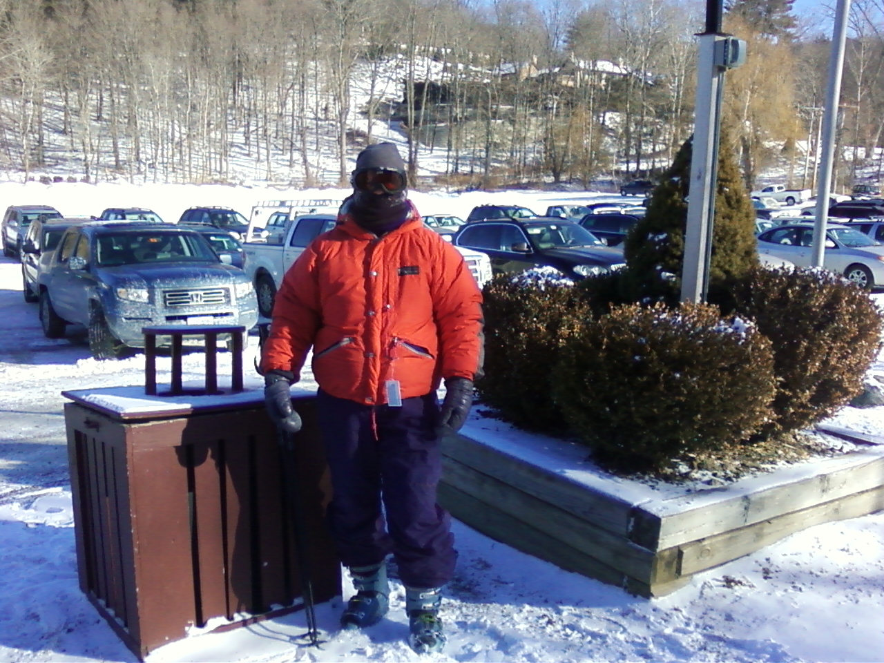
D. and I are just back from this year’s first overnight on the Appalachian Trail. This was our shakedown hike. We figured we could survive just about anything a Massachusetts summer might throw at us since we were only out for an overnight. We could see how we did with our gear choices, and tweak the details for a longer trip.
D. has decided we need to do western Maine, New Hampshire, and maybe the Maine 100-Mile Wilderness and Katahdin next summer — the first two of those are the hardest parts of the A.T., and the 100-Mile Wilderness is the longest food carry. She figures the younger we are when we tackle the hard parts, the better. (Having thru-hiked — and remembering how hard those sections were when I was 25+ years younger — I agree!) So this summer gives us a chance to figure out the details in the field and knock off some easier miles closer to home.
The only thing we were sloppy about was food. Both of our packs’ base weight was in the 12-13 pound area (we shared cookware, but each carried our own tent). So we had the luxury of taking too much food, which we did. I was testing out various new food products and a home dehydrated meal because I eat a ketogenic diet. Food planning for this way of eating is different than anything I’ve done before — I’ll post more on that in a separate article. We each also brought enough to share, which is hard to plan for. And D. brought FOUR (count them: FOUR) cans of red wine! I don’t think that’s going to be a regular thing on longer hikes, but it sure tasted good at the end of the day.
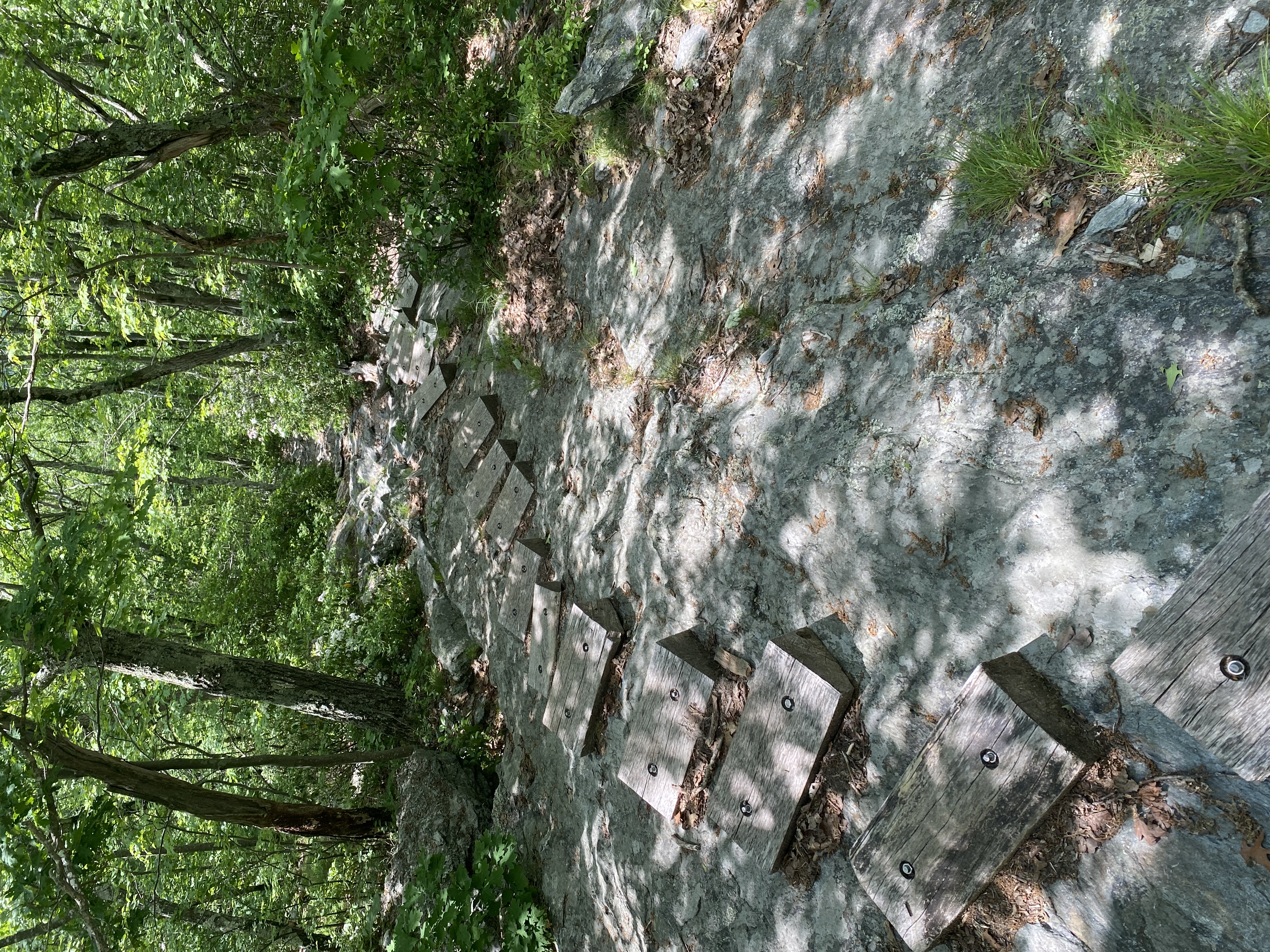
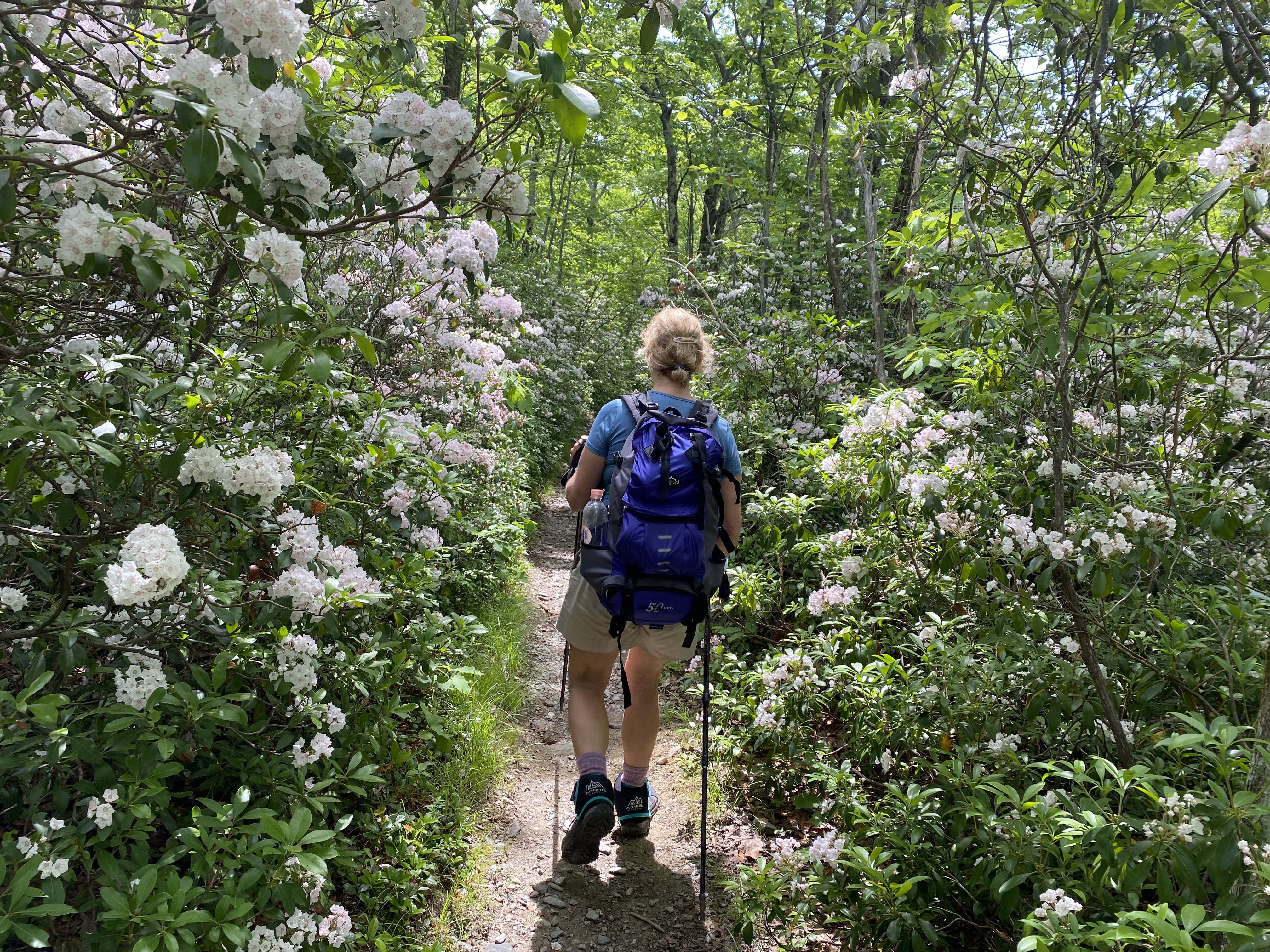
We hiked southbound from Guilder Pond in Massachusetts to Route 41 in Connecticut. It’s about a 13-mile section, so most thru-hikers do it (or more) in a day, but it’s the kind of mileage that slows down even thru-hikers with extensive sections of steep rock-strewn trail that require fancy footwork and some arm-assisted rock scrambling. The trail goes over the top of Mt. Everett, then down; back up over Race Mountain, then down, then up over Bear Mountain, then down — with a few PUDs (pointless ups and downs, in hiker-lingo) and ridges in between.
D. has not done any significant backpacking before — certainly nothing recently — and she felt tentative on some of the rock scrambles because of how the weight of her pack changed her center of gravity. I had the opposite experience: having hiked many thousands of miles with a pack weighting twice as much as this one, I felt as though I had nothing at all on my back. So we were coming at this from different directions.
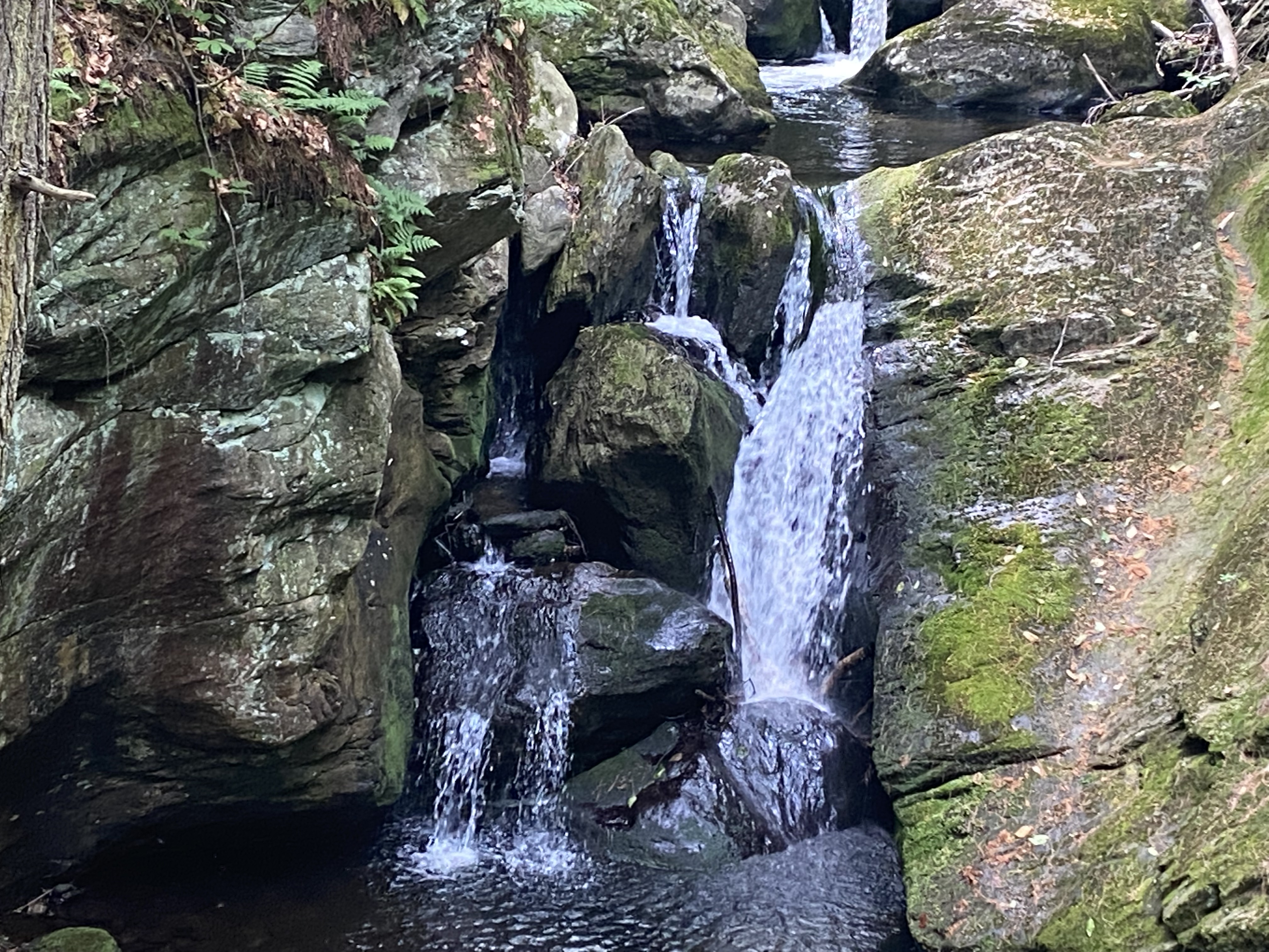
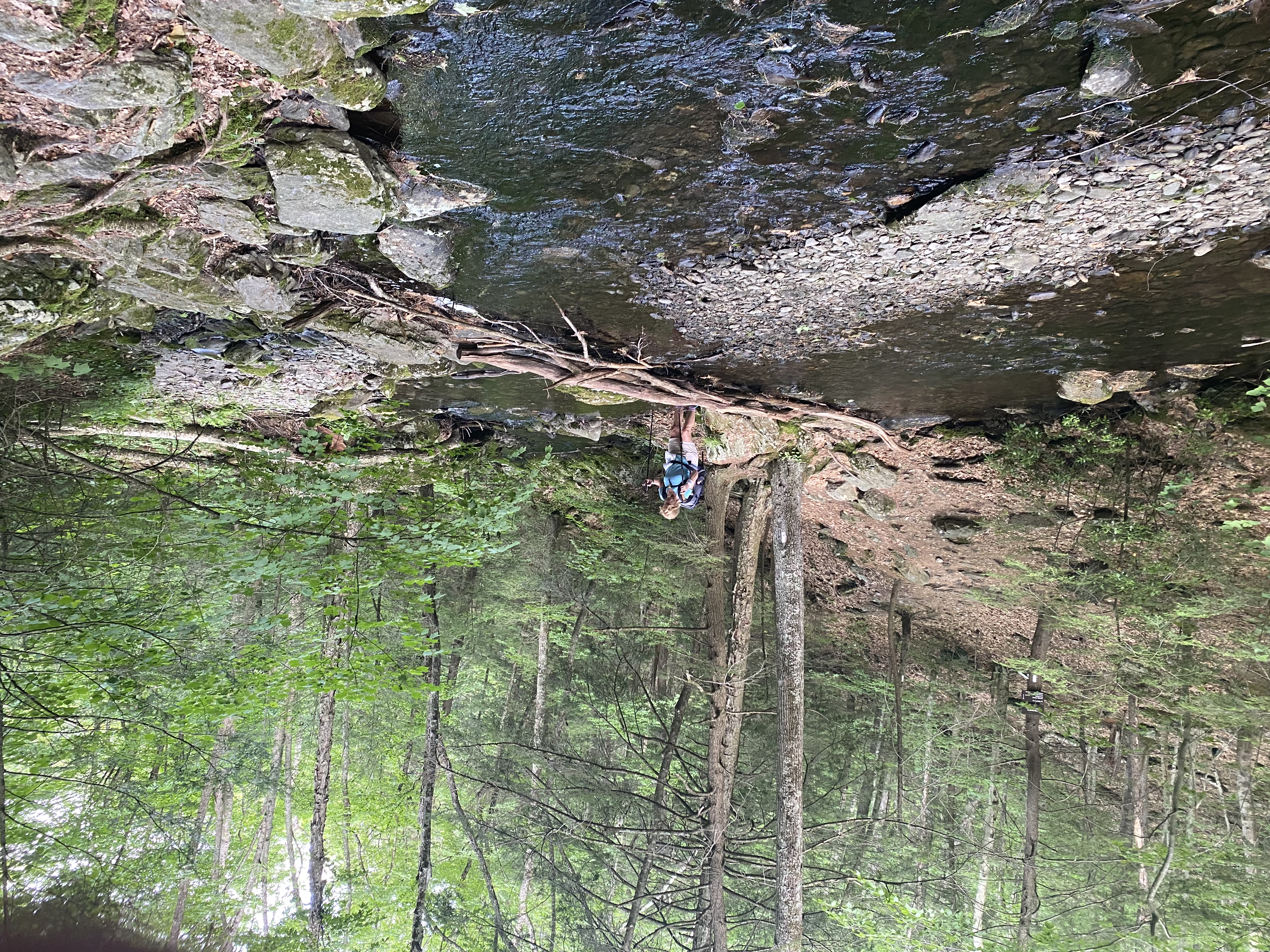
What we have in common is that we both were serious kid athletes in sports that involve a lot of falling (me in figure skating, D. as a gymnast) so we are both pretty good with balance — and we both “know” how to fall — knock on wood. So we are not overly fussed about crossing funky log bridges over streams or rock-hopping through muddy sections. Still, D. is cautious about falling, and she doesn’t overly care for heights and exposed ridges, so she’s still getting her bearings. If you were to fall and twist something here, you wouldn’t be stranded — we saw dozens of people over the course of our two-day hike, and almost always had cell service. But the trail here doesn’t cross a single road, even a dirt one, so help would have been far away. D. found that sobering — and the concept of rock-and ridge-scrambling for 90 miles of Western Maine seems daunting to her at the moment. Remembering how hard it was when I was more than 25 years younger makes it daunting to me, too.
For me, our fitness and pace are open questions. We’re not in a rush, but for planning purposes, it’s good to have a sense of pace and mileage/elevation limits. We are hiking at about two miles an hour when the terrain is not especially difficult. That seems slow to me — and the miles seem longer than I remembered. Elevation wise, I think I’m maxing out at around 2,000 feet in a day, depending, of course, on steepness and pack-weight. (Our longest day so far was about 12.5 miles, with just under 2000 feet of elevation gain — and only a day pack). By contrast, in my younger thru-hiking days — when fully acclimated and a couple of months into a long trip — I could cover twice that, and sometimes more. On the climb up to Bear Mountain, we slowed down to a mile an hour. Some of the descents were slow, as well, because of the steep rock scrambling. So I’m curious to know how much faster and stronger we might get, especially if we start hiking longer stretches and really break in.
On this part of the A.T., camping is restricted to shelters and designated campsites, of which there are plenty. This hike took place in the middle of the thru-hiker bubble, and it was a weekend (with the post-Covid city crowds flocking to their newly discovered outdoor hobbies). Our intended campsite was beautiful and very popular. So we planned our schedule so we’d be done hiking in the mid-afternoon, to assure ourselves of an open site.
Some highlights: This was the end of June and the height of mountain laurel season. We hiked a stretch called Laurel Ridge, and — it was indeed a ridge of laurel! Mountain laurel is found on many sections of the Appalachian Trail. On my 1994 thru-hike, I remember it being especially abundant and beautiful in Harriman State Park in New York. But this particular ridge, from about the top of Jug End all the way to Connecticut, is spectacular. Mountain laurel blooms the end of June.
And we saw a bear. This is a new thing on this part of the Appalachian Trail — though it is my understanding that on much of the A.T., bears have returned to areas where they didn’t used to hang out. I’ve been coming to this region of the A.T. since I was a little girl at a nearby summer camp, and bears were not a thing here back then. Even on my 1994 thru-hike, we never worried about bears in this region. Now they are all over the place: I live only a few miles away, and we see them and evidence of them (prints, scat, damage) on a regular basis. The bear we saw in the woods was close (and big) — but after exchanging polite hellos (his in the form of a snuffly kind of whuffing snort) we moved off in our respective and opposite directions.
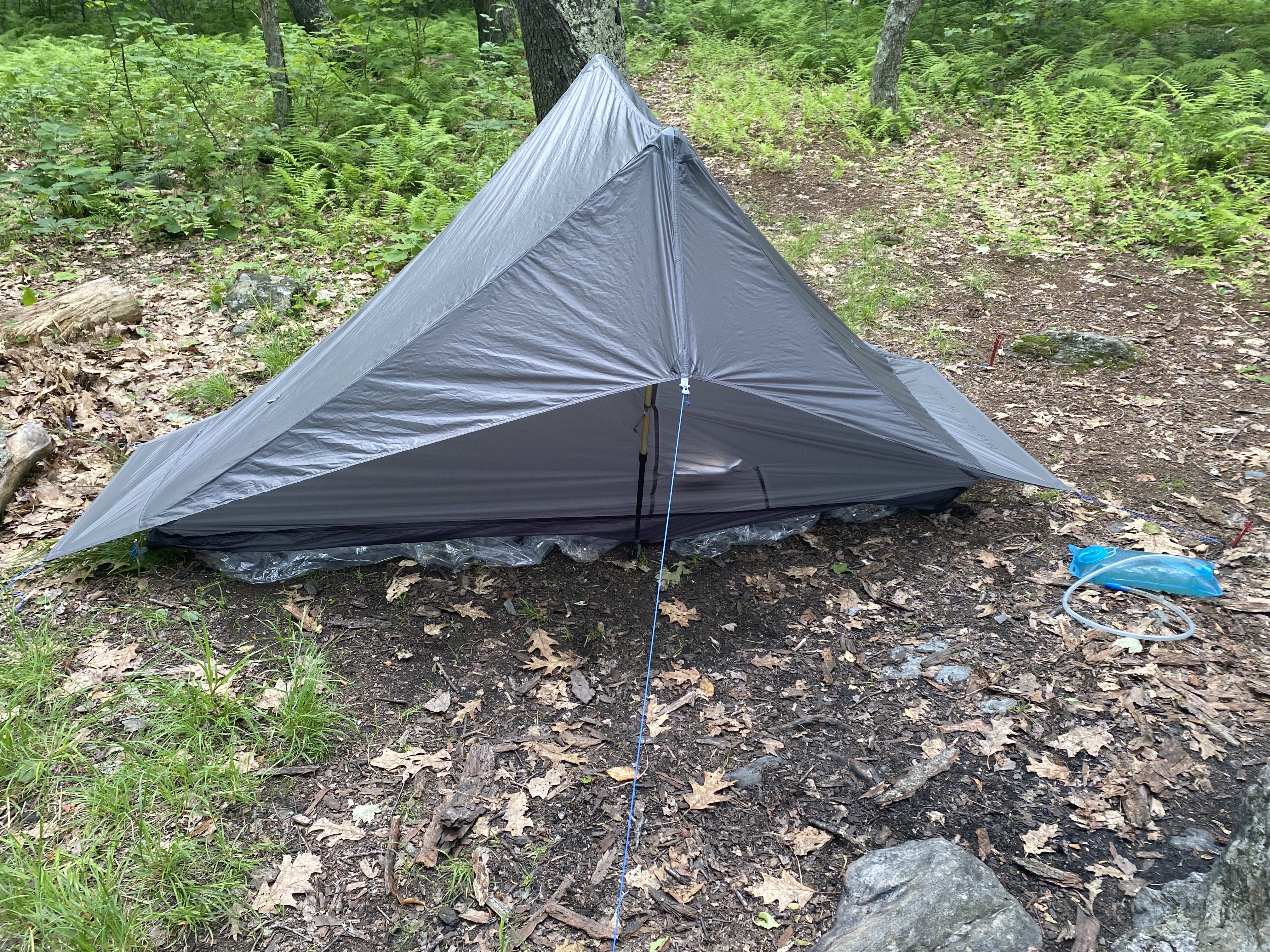
In the evening, contrary to the weather forecast, it rained. We sat out in a light drizzle for a while, drinking our wine, and hoping our tents would stay dry. D. had a new Black Diamond tent, supposedly big enough for two. I had a Gossamer Gear solo tent, which was generous for one. They looked about the same size. They were new to both of us, and we had both pitched them at home, but remembering how to do it in an actual campsite with rain threatening was a bit of a project, and when the rain started for real, we got to see just how well we did. Well enough, it turned out: It poured all night, the tents stayed up, tight and secure, and we both stayed 100 percent dry.
So in summary: Success! More details to come in future posts, but some notes:
The lightweight packs made a huge difference. Mine carried comfortably — no back, shoulder, or neck pain with a 20-ish pound load, which included a generous supply of unnecessary water and way too much food (we handed out our leftovers to thru-hikers we met on the trail the next day). I actually don’t even think I really felt the pack at all.
The Thermarest Uberlite was not only comfortable enough — it was WAY more comfortable than my old self-inflatable pads, though it was a little slippery (I’ll do a more thorough review in another post, probably after my next hike — I think my slightly slanted tent was a factor, so I want to see how it does on a flatter campsite).
Things that need tweaking: I’ve got a new sleeping quilt on order, and am hoping I like it better than my old Golite bag, which doesn’t have a full zipper, so there is very little flexibility in its temperature rating, plus there is the issue of that slippery sticky nylon against the skin.
We’ve also got to do some tweaking on our stove-pots-eating set-up, which was a bit too minimal for two people, and on our water carrying devices (bags/sacks/bottles; how many liters) — I think what we had was adequate but a bit inefficient.
Finally, I’ve reorganized my ditty bags to be more efficient. Things that I need on hand during the day (for example: water filter, bug dope and sunscreen) are carried in waist pouches and such. Things I need for camp (my toothbrush, camp towel, medications), go into one bag, and and things that are backups and emergency items ((first aid stuff, extra matches, battery charger) are stashed away until and unless needed.
But these are details, and will likely change as the weather changes, the length of the hike changes, and my gear evolves. Stay tuned!